
Etch Software Solutions
Connecting the mobility ecosystem with custom software solutions
Etch’s SaaS products include a mobility platform that consists of sophisticated trip planning, driver navigation, communication, and back office management. Our automatic vehicle locator (AVL)/ Connected Vehicle Environment (CVE) SaaS provides clients with real-time location information enriched to geospatial locations as well as the ability to manage fleet operations.
Etch Mobility Platform
Interoperability that connects internal and external users in order to reduce Public Transit confusion and anxiety


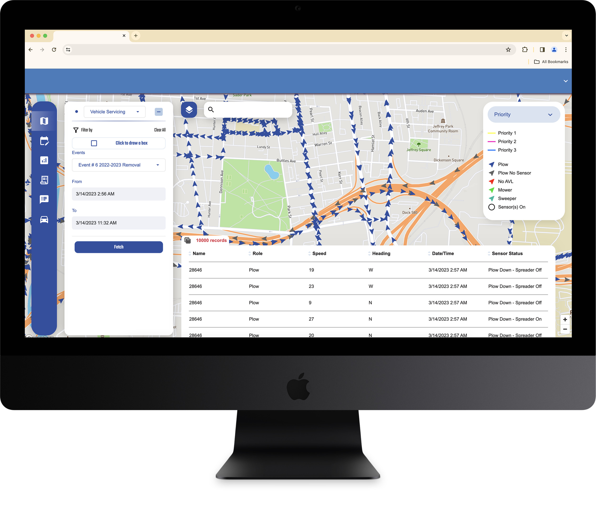
Etch Operations Platform
A software as a Solution (SaaS) product that enhances Automated Vehicle Location (AVL) and Connected Vehicle (CVE) operations and data for snow plow, mowing, sweeping, and leaf collection

-
![Truck plowing a snowy road near evergreen trees]()
Etch to release new Driver Module to enhance snow operation software
Plow drivers will be able to utilize the Driver Module application to track specific treatment types, zone completion, number of passes, and number of rounds. While tracking this information, the drivers will have access to a navigation system that provides directions to better understand the street network for efficient snow treatment and removal.
-
![Michigan road with autumn leaves]()
Saginaw County Road Commission honored with three statewide IMPRESS awards!
This year, SCRC received an IMPRESS award in Communications for the“Plow Locator;” and an award in Operations for “Drone Inventory Bulk Materials”
-
![Man in construction vest standing in front of equipment writing on a tablet computer]()
Featured product: Etch Mobility Platform
Etch’s Mobility Platform promotes interoperability to connect various participants including back office staff, travelers, and drivers, with an aim to reduce anxiety and confusion while using Public Transit.